Barossa Valley Lines to Truro, Penrice Quarry, and Angaston
Adelaide: Opened to future South Line Junction, and Torrens Bridge Junction, 21st Apr 1856 (600 metres), as part of the Port Adelaide line (3).
Torrens Bridge Junction to Gawler Line: Opened 1857 (3)
North Adelaide, Ovingham, Islington, Dry Creek, Parafield, Salisbury
Nurlutta, Elizabeth South, Elizabeth, Womma, Broadmeadows, Smithfield
Munno Para, Kudla, Tambelin, Evanston
Gawler: Line extended to Kapunda 1860 (1). Branch line opened to Angaston 1911.
Gawler Oval: 25.75 miles
Gawler Central: 26m 16ch. Current (2024) end of rail line. Formerly known as North Gawler.
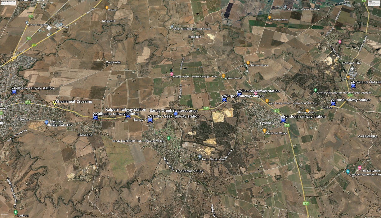
Railway Stations in the Pelberre - Rowland Flat Section
Video of stations Pelberre to Wilamba (Jan 2024)
Pelberre: The site of Pelberre, facing Gawler, with Whitelaw Creek Gully on the right. The rail line hugged the gully here.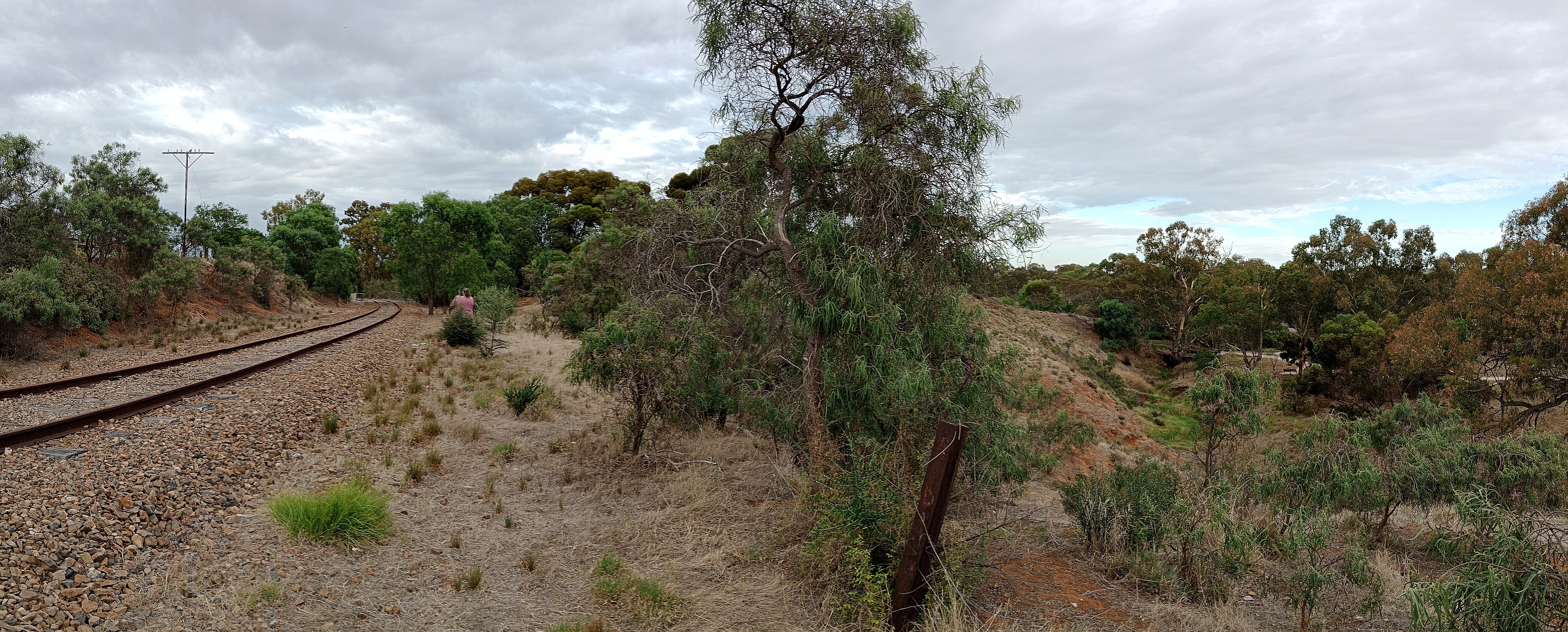
Pelberre existed as a stopping place for trains. It does not appear to be a locality / town / suburb, but is shown on the SAPPA map as a railway station. Also listed as a "railway station near Gawler" in, Place Names of South Australia, and meaning "fruit" in an Australian Indigenous language. Not shown on a 1968 map [(4) p212] of railway stopping places / stations.
Wheatsheaf level crossing (4)p212.
Kalbeeba: Opened 1st July 1925 (4)p161; On 1968 map (4)p212.
Kalperri: On 1968 map (4)p212.
Sandy Creek: 31m 4ch. 49.9km. A major location, with the main line, two loop sidings, and one or two dead-end sidings. Only the disused main line track remains as at 2023. Closed 1st January 1977 (4) p208.
Sandy Creek was located adjacent to the Williamstown Road level crossing, from where the photograph below was taken in August 2023.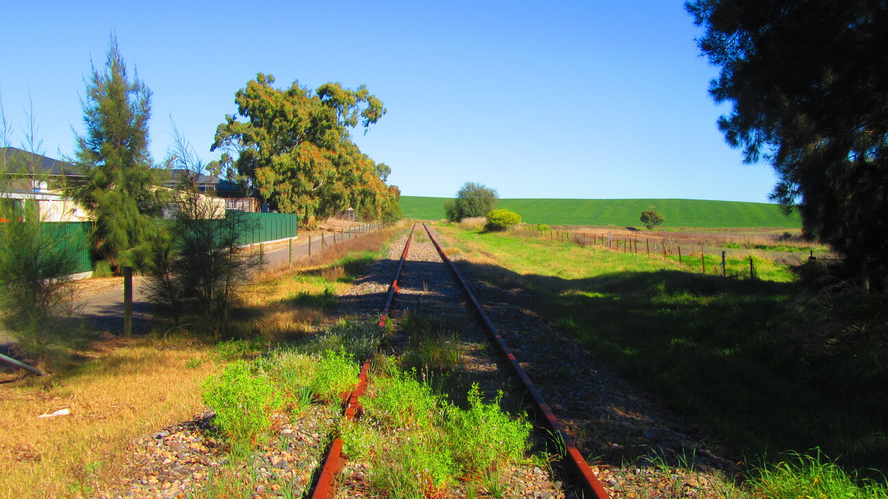
A bike / walking trail runs through the former rail yard and station, on the left in the above photo. The platform appears to have been where the trees are seen at the end of the green fence. The goods platform would be on the opposite side of the main line, where the smaller trees, and patch of brown grasses are. Barossa Valley Way is out of photograph, on the right hand side. This picture is facing the Gawler end of the line.
There is an historical information plaque on the bike / walk trail, out of photograph. It tells of the Sandy Creek Military Camp, used during World War 2, including (briefly) as an internment camp, which was located within a mile of the level crossing. However there is no mention whatsoever of the railway station and yard. A passing cyclist stopped to say hello and was surprised to learn the station existed here. Newspaper reports tell of an active community at Sandy Creek. But not enough to keep the station open in the face of motor cars on the adjacent, well used, road.
Williamstown Road level crossing, 50.0km (4)p208.
Warpoo: Originally Haese's Crossing. A stopping place with a step-down platform. 1st July 1925 opened. Closed 1969, and station name board removed. [(4) p161, 199, 208, 212]. Located adjacent the Kings Cutting Road level crossing. No references found to any community here as such, so the station would have served people in the neighboring farms.
When the railway line was planned through here, Kings Cutting Road was found to cross the line in the middle of a deep cutting necessary to keep the line reasonably level. Roads can go over hills but railway lines tend to go through them in cuttings or tunnels. Presumably to avoid the cost of a bridge to take Kings Cutting Road over the railway line cutting, it was decided to redirect the road to its current location, at the Lyndoch end of the rail cutting. It was at this level crossing that Warpoo station was located, seemingly on the Lyndoch side of the crossing. This is based on a location visit to assess the topography. In the absence of photographs / reports, a site visit is the only way to make an "educated guess" on platform locations. Looking for "spaces" in the landscape that are "platform sized", and accessible to people wanting to catch the train. At least Warpoo had a platform; some stations were simply a designated stopping place, often at a level crossing, where passengers exited the train directly to the ground.
Wilamba: Located at the level crossing with Jolleytown Road (4) p209. On 1968 map (4) p212. Station name board removed 1969 (4) p199.
Lyndoch: 35m 29ch. On 1968 map (4)p212.
Dec 2023 video walkthrough of Lyndoch rail yard, from Lost In South OZ Youtube channel
Altona: On 1968 map (4)p212.
Rowland Flat: 38m 44ch. Also known as Rowland's Flat. "Lat :-34.5874094 Long:138.9291024" (SAPPA). On 1968 map (4)p212.
site of Rowland Flat rail yard, facing Tanunda, with cemetery behind the photographer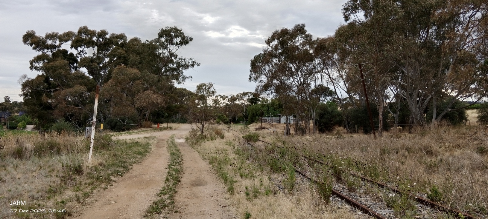
Jacob's Creek Bridge
Kabminye: Kabminye station site.jpg)
SAPPA
Bethany:
site of Bethany station, looking toward Tanunda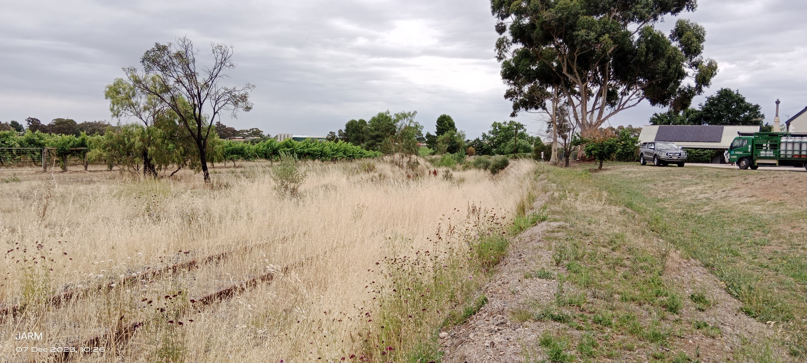
1923 SAPPA.
Tanunda: 43m 64ch.
Dorrien: 46m 12ch. Also known as Seppelts. (SAPPA). Closed to all trains 1st July 1973 (4) p203.
Nuriootpa: 47m 74ch. 47.90km. Station opened 15th May 1911 [(4) p125]. Became the junction of the Truro / Penrice Quarry line.
Dec 1923 video walkthrough of Nuriootpa rail yard, from Lost in South OZ YouTube channel
Nuraip: (4) p211
Turrung: (4) p211
Cement Works - (4) p211
Angaston: 51m 42ch. 83km peg (4)p211. Station opened 8th September 1911 (4)p129
Penrice Junction
Penrice Quarry:
Kyeema:
Stockwell: 52.78km.
Truro: 57.91km.
Finsbury Munitions Plant Site Layout and Rail
Site layout of Finsbury Munitions Plant by Julie McDonald, based on various sources - CSIRO Plan, Rails Through Swamp and Sand, and a June 2024 walkthrough by Lost in South Oz. Overlaid on current Google Earth image.
The thin green line is the Munitions Plant boundary, as best I can tell from the online CSIRO Plan. Note that Finsbury railway station is outside the Plant boundary. The yellow lines are the railway lines and sidings, overlaid as best as I can guess on the current (2024) site. The four short blue lines are small lengths of rail track still in situ, as seen during the walkthrough. No.2 Fuze Shop was demolished June 2024.
From what I've read the Munitions Plant site has been assessed for historical value. While it is historical, preservation was not supported as there are other examples of the structures and layout in Australia. Further, while locally significant, Finsbury was a relatively small part of Australia's munitions production.
Hamley Bridge Railway Station and Yard
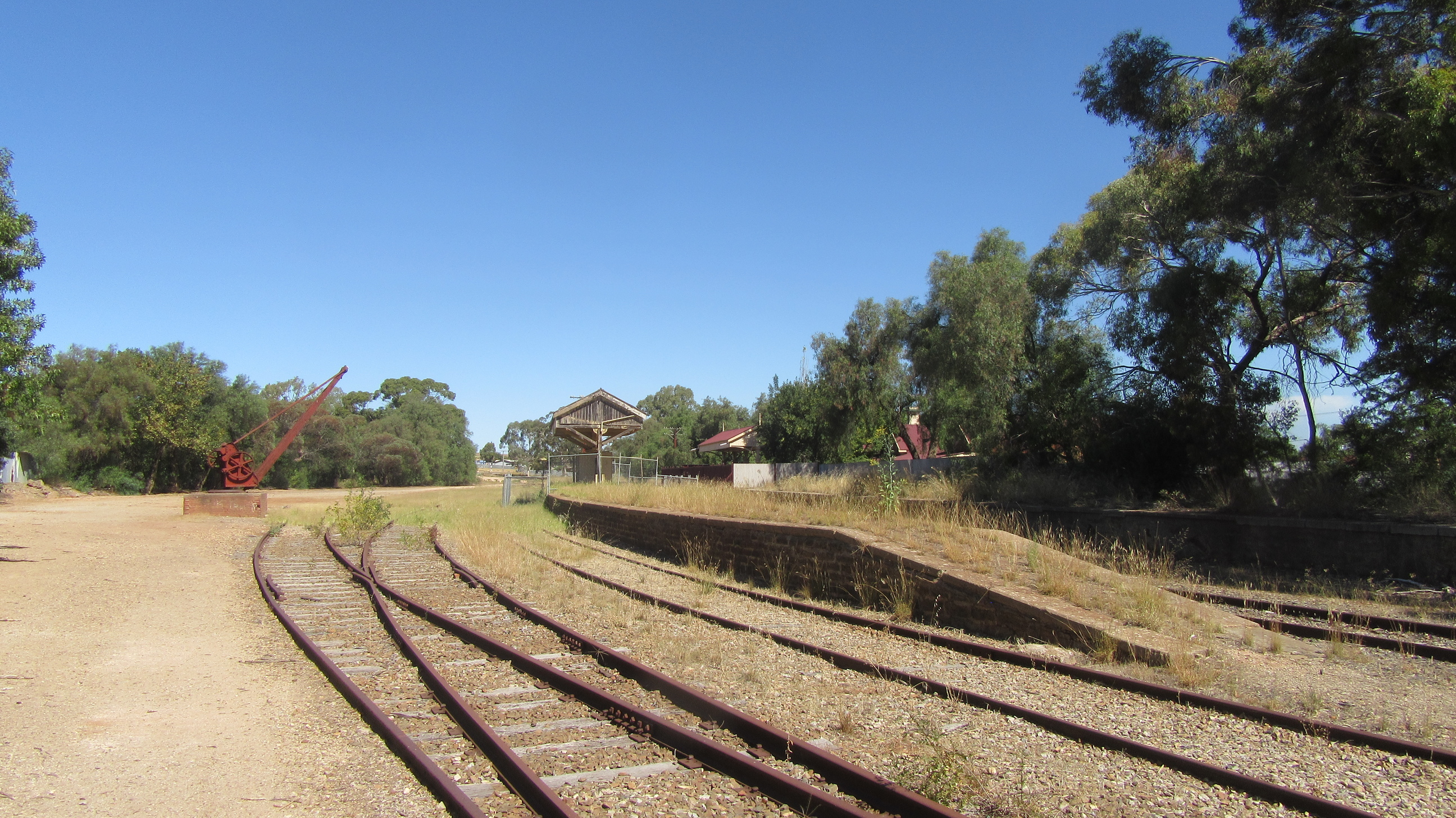
Railway Station, Rail Yard, and Crane.
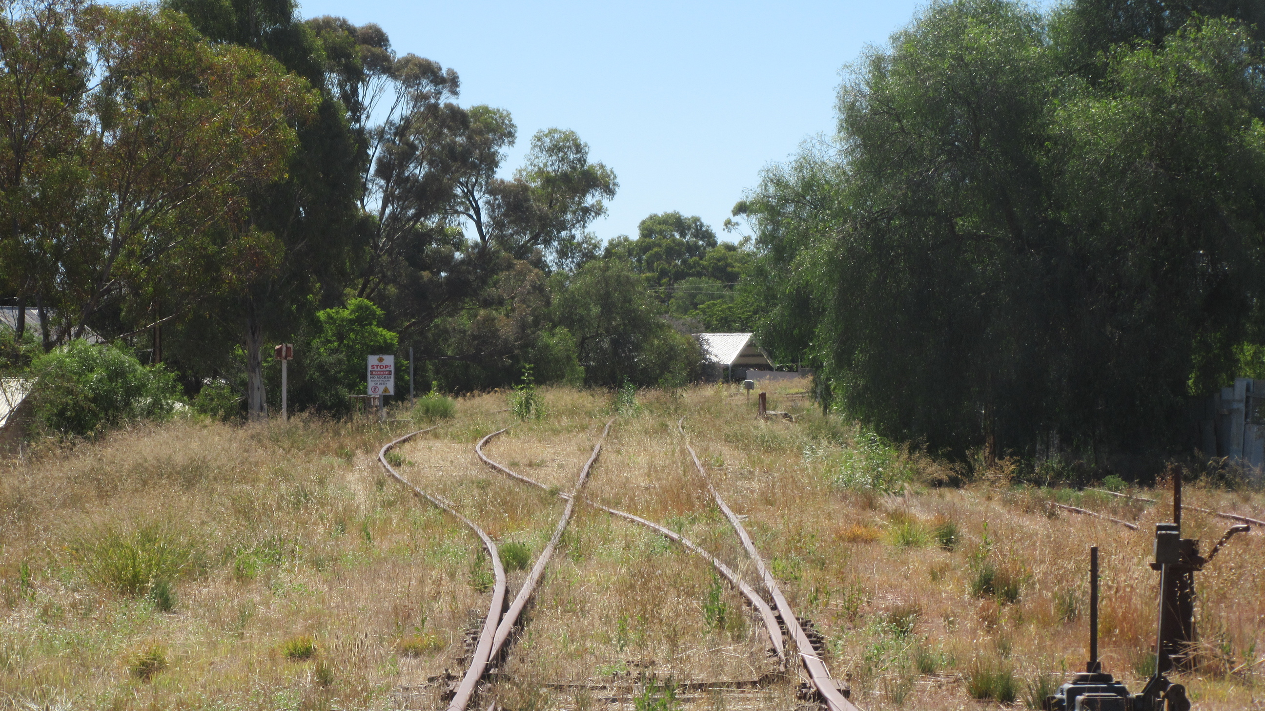
Junction of the Balaklava (left) and Terowie (right) lines.
The line through Hamley Bridge, from Roseworthy to Tarlee, was opened July 1869 (1,2). Regular passenger services finished in 1986, with the last freight service in 2006 (2). The rail company Aurizon is the current holder of a 50-year lease of the rail corridor (lease began 1997), and ownership of the rail infrastructure (2). However, as a walkthrough of Hamley Bridge rail yard in February 2024 revealed, the rail line is in disrepair here, and at other locations (2). The purpose of this page is to present a history of the rail yard and station at Hamley Bridge, and via the associated Lost in South OZ video, document its current state.
- 1857: Adelaide to Gawler railway opened (broad guage).
- 1860: Rail line extended from Gawler, through Roseworthy, to Kapunda (broad guage).
- 1869: Rail line opened from Roseworthy, through Hamley Bridge, to Tarlee (broad guage) (1).
- 1870: The Port Wakefield to Hoyleton, via Balaklava, rail line (narrow guage) opened. Operated by horses (1).
- 1876: Port Wakefield to Hoyleton narrow guage line changed from horse-drawn trains to locomotive hauled trains. Part of a developing narrow guage railway system to the north and north-west of Hamley Bridge (1); independent of the broad guage lines from Adelaide. The reasons for different guages is a story for elsewhere.
- 1880, January: Narrow guage railway line opened from Balaklava to Hamley Bridge. Making Hamley Bridge the first dual-guage main line station and rail yard in Australia (3). All narrow-guage trains from Balaklava terminated here, since the narrow-guage line did not proceed any further. Passengers and freight from Balaklava (and its associated lines - all narrow guage) changed to broad guage trains to continue south toward Gawler and Adelaide, or north toward Burra and Peterborough. Today's decrepit railway lines were once the main route from Adelaide toward Perth, Alice Springs, Broken Hill, and Sydney.
- 1897: Sheep, flour, and wheat were major commodities listed in the Railways Commissioner Annual Report for 1896-97.
- 1907: A Mrs Johns, arriving Hamley Bridge on the narrow guage train from Kadina, fell between the train and platform while alighting. Her and her husband were changing to the Adelaide broad guage train to visit friends in Adelaide. Mrs Johns was conveyed by that train to Adelaide and then to Adelaide Hospital. Surgery was performed successfully but Mrs Johns didn't recover from the anaesthetic, and died. (7)
- 1908: Newspaper reports discussed the plans to convert the Hamley Bridge-Balaklava narrow guage line to broad guage, shifting the guage change location to Balaklava. Inadequacies of Hamley Bridge rail yard as a transhipping point, for freight particularly, were noted. Also noted was railway staff had purchased homes in Hamley Bridge in anticipation of their jobs staying there, not moving to, say, Balaklava. (5)
- 1927: Along with the associated narrow guage rail lines, the line from Balaklava was converted to broad guage, thus ending Hamley Bridge's role as a change of guage transhipping location (1). The above map, showing the rail yard as it is in 2024, reflects the post-1927 yard layout.
- 1928: 7th December - The East-West passenger train was arriving from Adelaide when it derailed approaching the platform. Despite severe damage to the track, only the steam locomotive and first couple of carriages left the track. No injuries were reported. The remaining carriages were moved to an adjacent track, another locomotive was found, and passengers continued on their journey about an hour later. (4)
- 1986: Hamley Bridge railway station became unstaffed and regular passenger services finished (2,6). Freight services continued for another twenty years.
Hendon Munitions Factory Site
.png)
The Hendon rail line, branching off the existing Grange (former Henley Beach) line at Albert Park Station. Hendon Station consisted of an "island" platform and four tracks. Albert Park Station was as shown, an "island" platform, two tracks and switches / points. This platform remains but with one track only for the existing Grange line.
The light maroon coloured area above Hendon Station is the location of Hendon Munitions Factory.
Sketched by JARM, on Google Earth, using various sources.
Timeline of Hendon Munitions Factory Site
- Ostrich farm
- Airport
- Munitions factory
- Nov 1939: construction of Munitions Factory began (Flickr photo by: aquilareen)
- Jan 1951: rail corridor transferred from the Commonwealth of Australia (Federal Government) to the South Australian Government railways ([SAILIS] Certificate of Title Vol.2123 Folio 59).
- Industrial site
- Present day
Murray Bridge
The above map indicates the extent of the railway corridor at Murray Bridge. Today only the main line through the platform, and an almost one kilometre loop track are in use. These are the blue lines on the map. The additional blue lines at the west end, near the silos, are no longer in service. All blue lines are standard guage.
The green lines are the former branch line to the riverside wharves, and associated rail yard, including a siding to the flour mill. These lines were broad guage. Although noted as serviceable in the mid-1990's, the green lines had no traffic and became isolated when the main line was converted from broad guage to standard guage. Today (2024) many of the green lines remain in situ, although some are covered by road tar. The area is set up as an historic precinct, with a steam locomotive and freight rollingstock on display. Information plaques are located in the area.
The brown-red lines on the map are the original rail line across the first bridge at Murray Bridge, and the broad guage rail yard. This yard covered the area now occupied by the standard guage tracks shown in blue, including the main line over the second rail bridge.
- 1886: Rail line opened through Murray Bridge, and across the first of the two bridges shown on the map (with the brown-red line).
- 1925: Second rail bridge opened (the bridge with the blue line on the map), and the first rail (and road) bridge became a road only bridge.
Port Adelaide Line and Branches
Port Adelaide Line
Opened 21st Apr 1856 (3).
Torrens Bridge Junction
Bowden:
shown 1911 railway map.
Croydon:
shown 1911 railway map.
The Port Adelaide railway line originally ran to a station on the site of the current (2024) police station. The current Railway Museum is on the site of the associated goods yard. The rail line traversed St Vincent St, then across Jervois Bridge (an earlier bridge structure however), to Glanville, then the site of the current Largs station, and on to Largs Bay Jetty, where the line terminated on the jetty itself.
In 1908 the line from the existing Largs station to the jetty was closed when the line was extended to Outer Harbour.
The myriad of shipping and industrial activity in and around Port Adelaide led to a "rabbit warren" of sidings on all four sides of the business district - making the area essentially an enormous railway yard.
Wingfield Railway Station
Shown in Gregory's Street Directory 20th Ed. (approx 1970)
Site, Dec 2023, of Wingfield Road railway level crossing
(middle of photo), and the railway station,
to the right of the level crossing.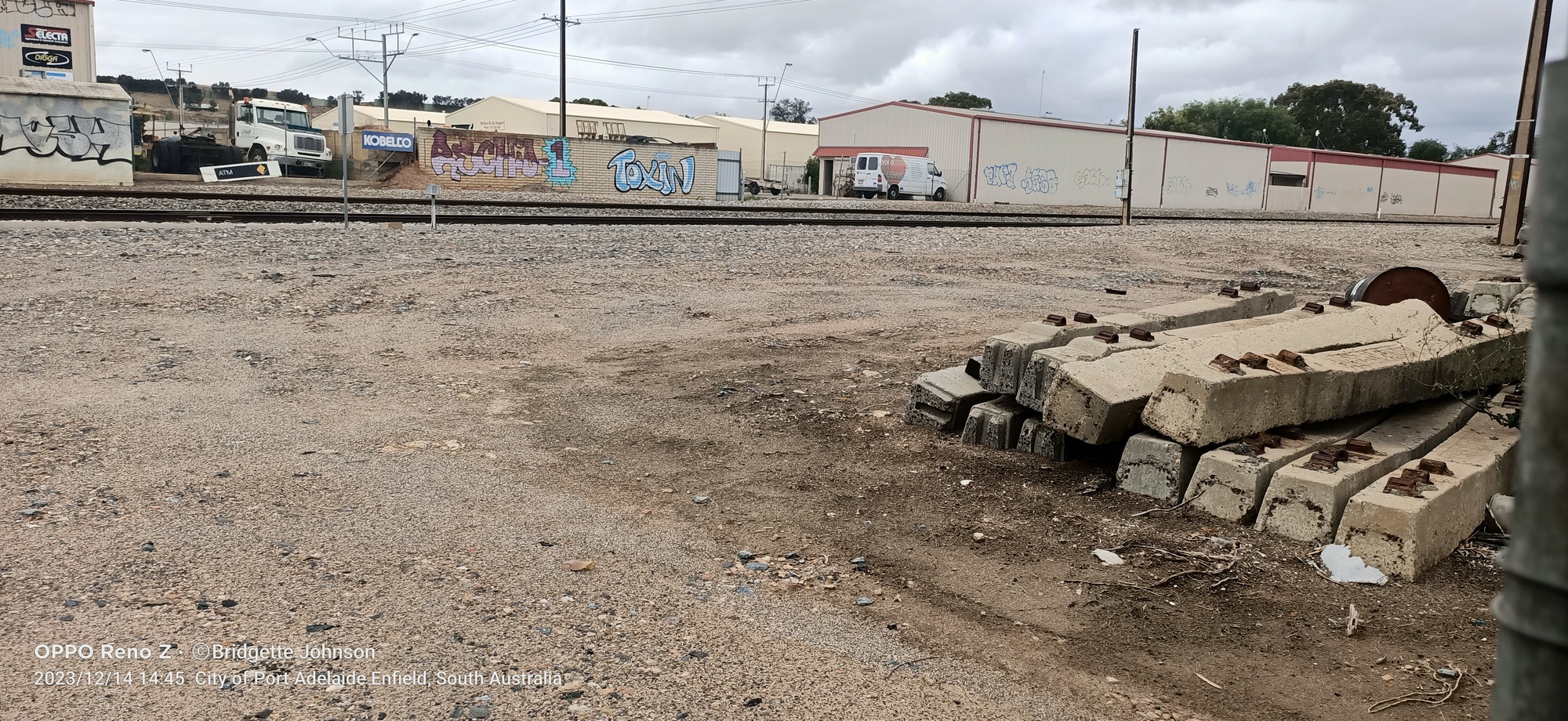
North Arm Road Railway Station
Shown in Gregory's Street Directory 20th Ed. (approx 1970)
Panorama photo of North Arm Road station site;
Dec 2023; the left of the level crossing (North Arm Road).. Panorama photo.jpg)
Rosewater Railway Station
Shown in Gregory's Street Directory 20th Ed. (approx 1970)
Rosewater mid 1980's
(photo by Julie McDonald)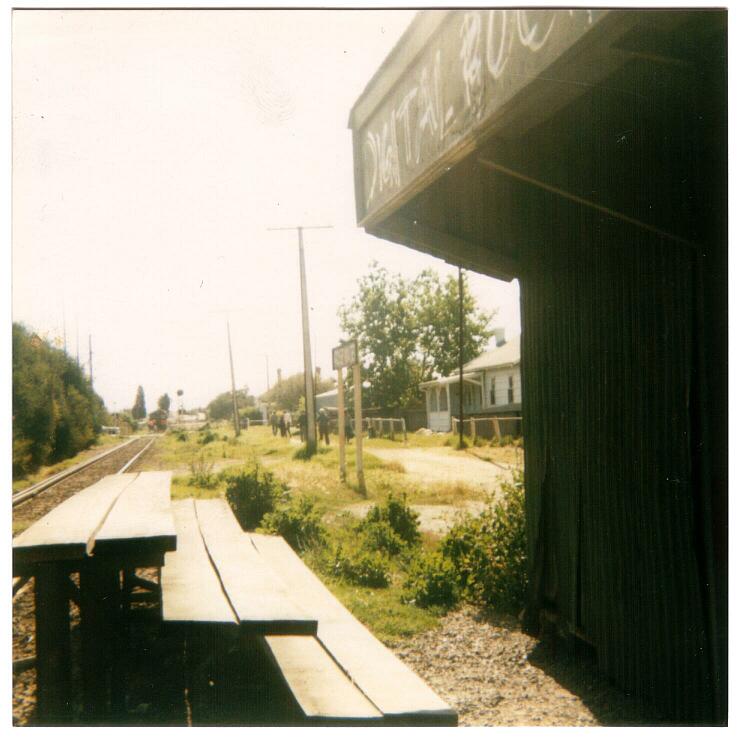
The site of Rosewater station in Dec 2023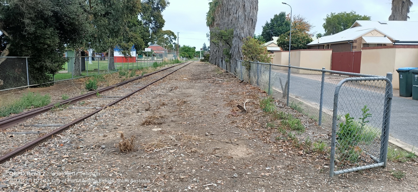
Port Wakefield
Salisbury Munitions Site
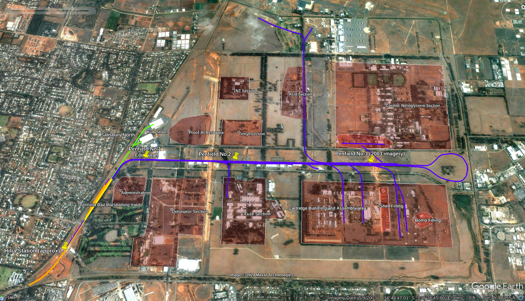
Created the above map of the broad guage rail network, and production areas, of the Salisbury Munitions Plant, using various information sources. The background satellite image is the Google Earth Historical Image from May 2003. The light rail networks are not shown since they are much smaller and confined to individual production areas.
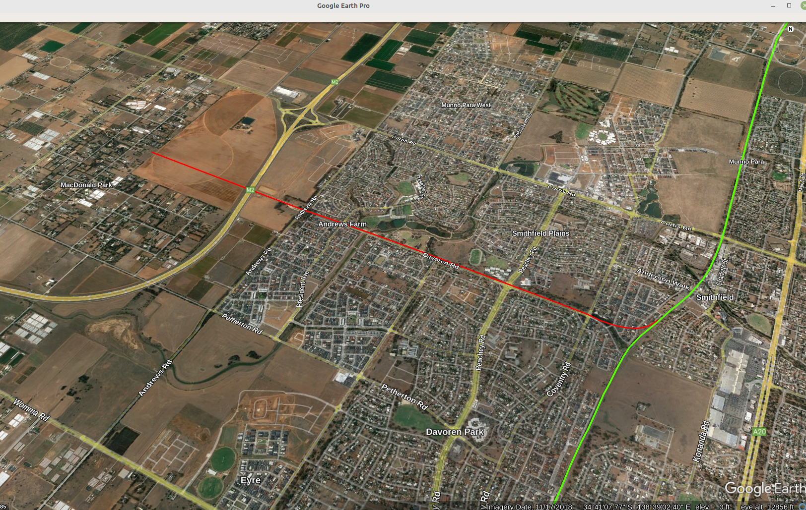
Smithfield Munitions Railway Line (Davoren Road)
This line is a good example of the idea that history happens in suburbia, where people live - not somewhere "over there". Looking at early plans / maps of the northern Elizabeth area I noticed alongside Davoren Road a space marked "railway". Having no knowledge then of a rail line anywhere near Davoren Road I put this mark down to a proposal that got left on the drawing board.
However, a railway line was built alongside Davoren Road, beginning at the existing Smithfield rail station, to the present day MacDonald Park.
South Hummocks Railway Station
Within a large area (2000ha) of salt marsh / swamp at the head of the Gulf St Vincent, South Australia, lies a small patch of ground that looks like this:
South Hummocks Station site, facing Moonta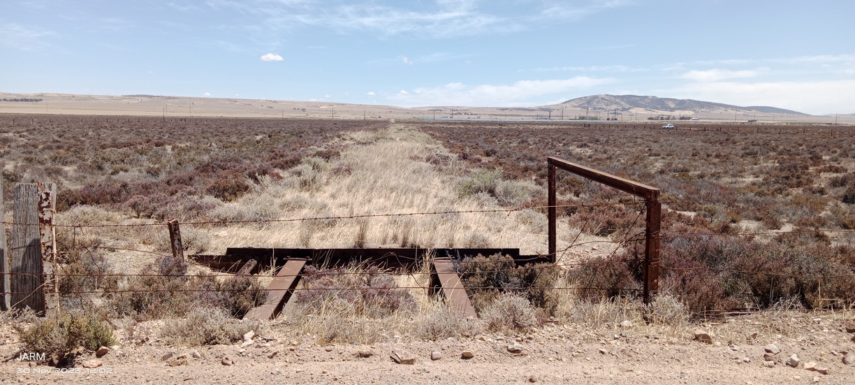
The pale yellow-brown streak heading toward the hills on the horizon is the old railway corridor toward Kadina. The rail line was on higher ground above the darker coloured surrounding marsh. On the surface of the marsh can be found sea-shells, despite being several kilometres from the coast.
South Hummocks railway station, the site (2023) pictured above, was located on the Port Wakefield to Kadina railway line, which opened 9th October 1878, as a narrow guage line. Being converted to broad guage in August 1927. Despite its less than ideal location geographically - building anything in a marsh is not advisable - South Hummocks railway station was the connecting point in 1901 for road coach runs to Port Price and Ardrossan, on the west coast of the Gulf. It was a loading point for wheat from the district, as evidenced by a 5000 bag stack of wheat at the South Hummocks rail siding in January 1948, which caught fire. Enough people were at hand to bring the fire under control, with only about 1000 bags destroyed.
The railway station had the single track main line, while the platform was situated on a 500ft long loop track, with a 200ft long siding off the Moonta end of the loop. In March 1918, a railway employee, Harry Henderson, was killed during a shunting accident here.
During a visit in 2023, I can attest to the softness of even the dirt road approaching the station site. The car sank into the road, coating the tyre treads in a layer of sandy mud. Despite being close to two main roads, I felt I was in the proverbial middle of nowhere. Looking at the station site, quite clear on the SAPPA map, it is difficult to believe the above "busyness" ever took place here. The line closed in April 1984.
Tanunda Railway Environs
43miles 64chains
 1600x (GE, JARM).jpg)
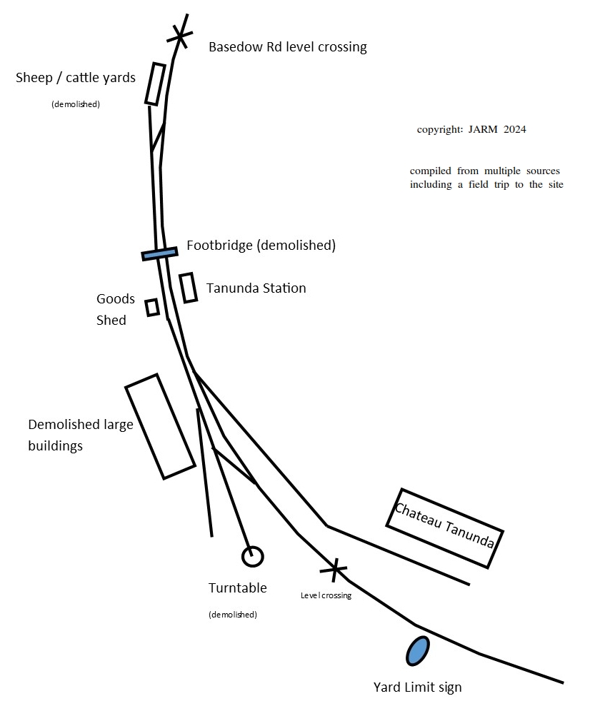
The blue lines indicate the rail lines between Tanunda Station and Chateau Tanunda. Sketched by JARM on Google Earth map.
On the right, sketch map of Tanunda rail yard, showing existing and demolished structures. Platform. Turntable, Goods Shed, rail yard, and crane (the base of which remains near the Goods Shed). Siding from Gawler end of rail yard to Chateau Tanunda.
Dec 2023 video walkthrough of Tanunda rail yard, from Lost In South OZ Youtube channel
Bibliography:
1860 'OPENING OF THE KAPUNDA RAILWAY.', The South Australian Advertiser (Adelaide, SA : 1858 - 1889), 14 August, p. 3. , viewed 26 Dec 2023, http://nla.gov.au/nla.news-article822747
1860 'THE RAILWAY BETWEEN GAWLER AND KAPUNDA.', The Argus (Melbourne, Vic. : 1848 - 1957), 2 July, p. 7. , viewed 26 Dec 2023, http://nla.gov.au/nla.news-article5685352
 1600x (GE, JARM).jpg)
 1600x (GE, JARM).jpg)
 1600x (GE, JARM).jpg)
 1600x.jpg)
 edit.png)
 1600x (GE, JARM).jpg)
 1600x.jpg)
